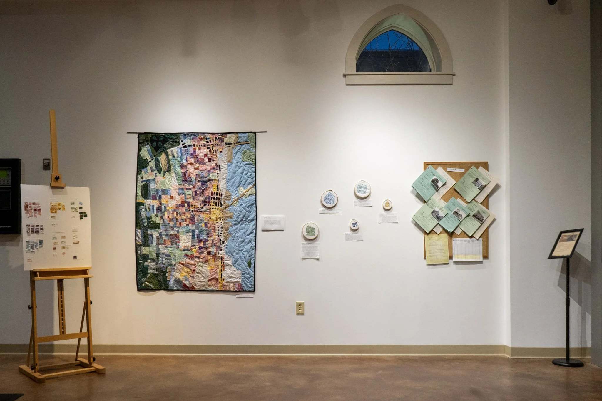
Quilting Urban Renewal
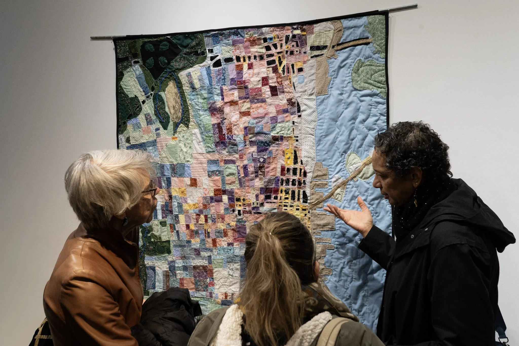
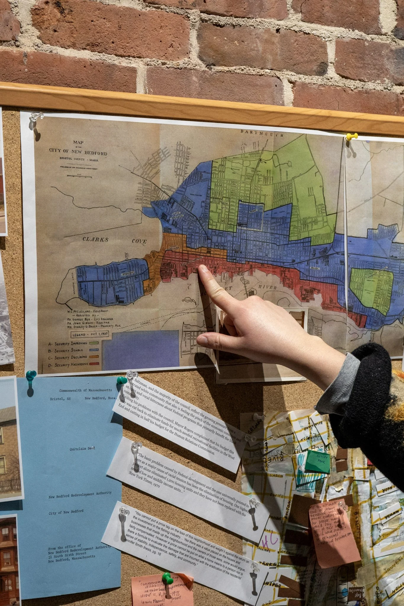
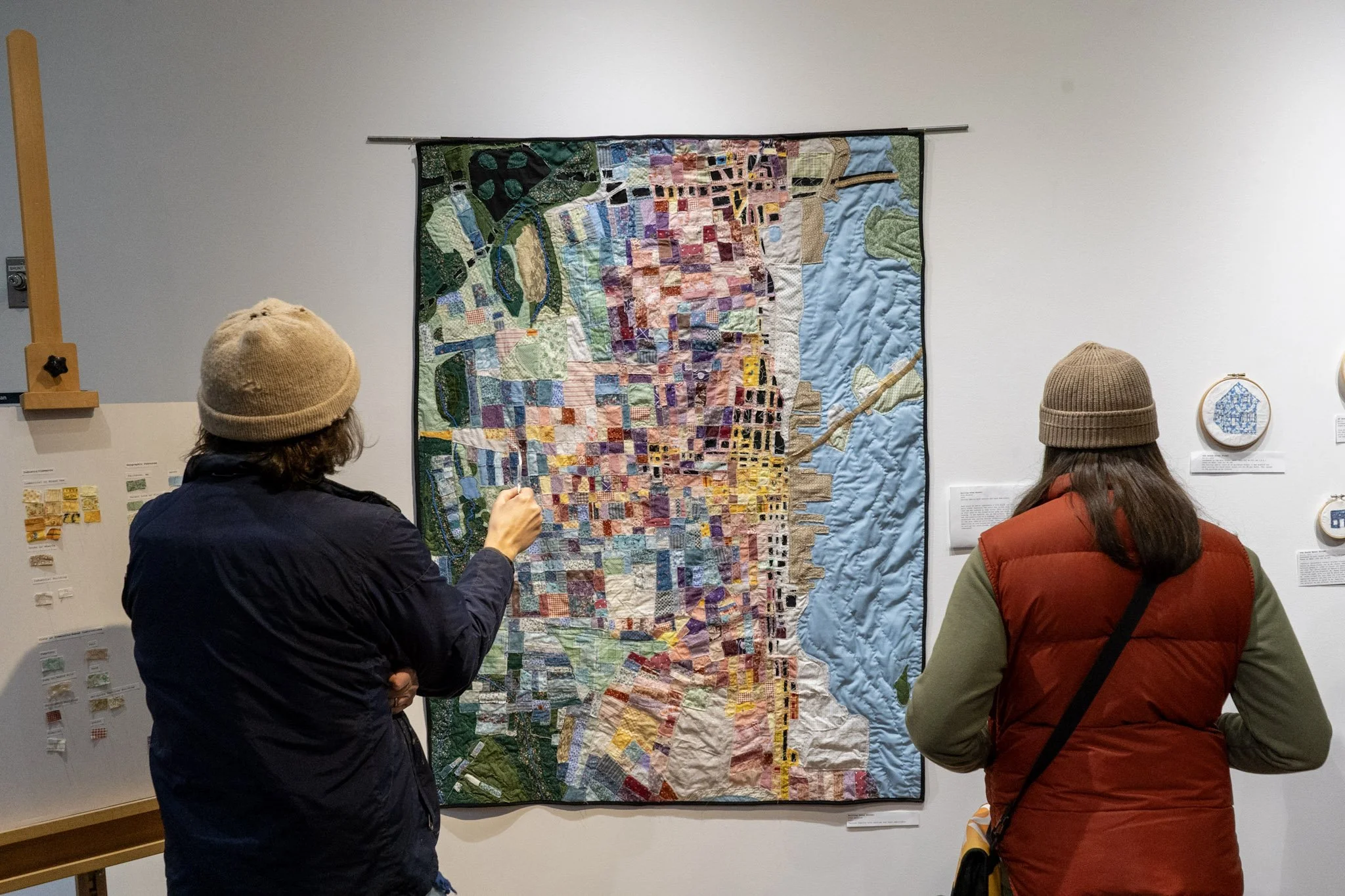
I created a quilt that maps the impact of urban renewal in New Bedford from the 1960s through the 1970s. The quilt shows how the construction of I-195 and Route 18, along with “slum mitigation” policies led to the destruction of immigrant and working class neighborhoods.
Quilt Construction & Design
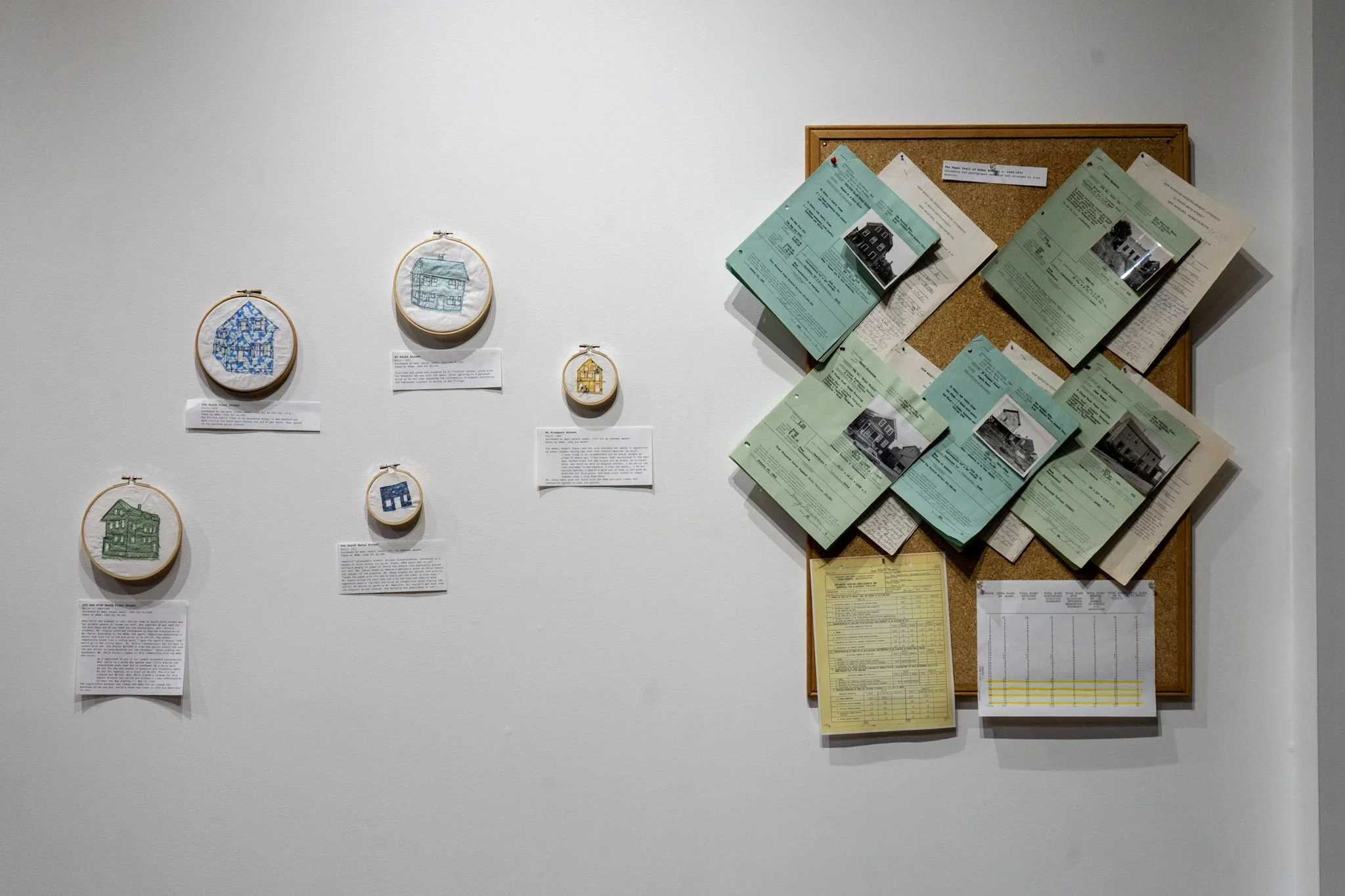
Each block of fabric represents a city block and what it was in the early 1960s. A color key designates the type of buildings or land located on that back: for example, multi family housing represented by pinks and purples, a graveyard by green squares, a forest in dark green, businesses in yellow, etc. There are large chunks of this quilt that have since been developed into housing. In New Bedford, one of the primary impacts of urban renewal was the construction of a highway, splitting New Bedford from the waterfront and cutting through neighborhoods, displacing residents. Where the highways cut through the quilts or urban renewal policies destroyed neighborhoods, I will be cutting through the quilt, leaving it frayed and worn.
Research
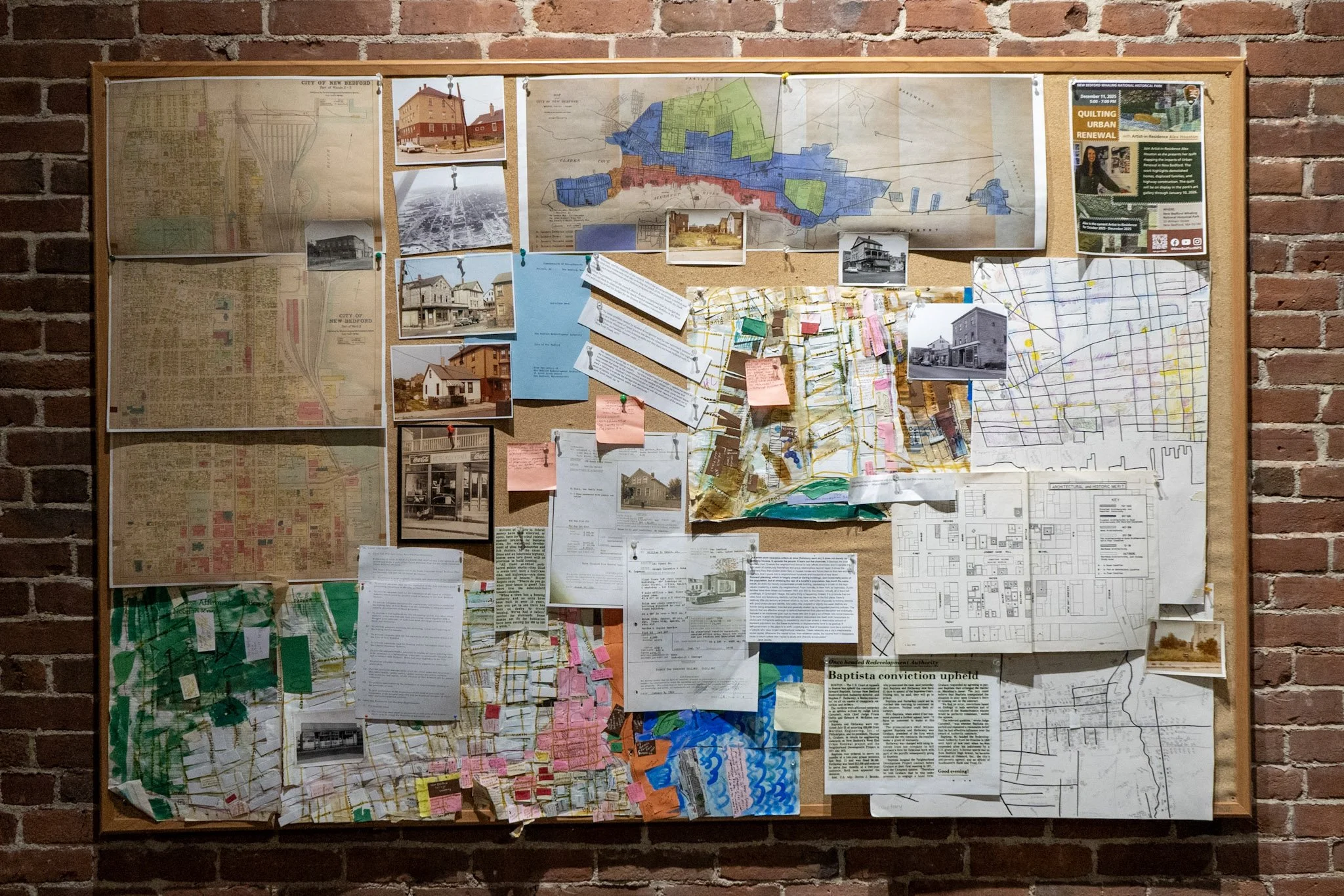
This project provides a fascinating opportunity to understand why New Bedford looks the way it does today. To figure out what each block of the city looked like in the early 1960s, I’ve used 1960s phone books, aerial images of the city, Standard Times microfilm, and historic photographs.